by JRobins | Mar 1, 2025 | Historic Marker
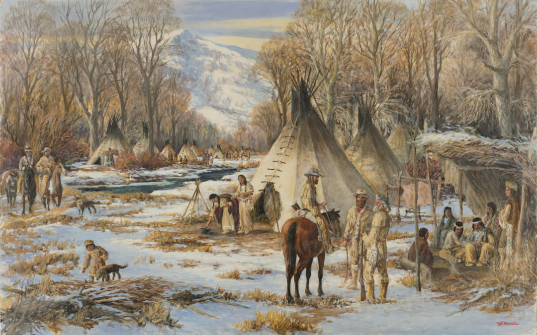
Trappers Winter Camp HISTORIC MARKER 701 E. Nicholls Rd. Fruit Heights, Utah – (Gaily Trail parking lot)41° 01′ 20.8″ N • 111° 55′ 27.0″ W Atypical over-wintering settlement strategy utilized by Rocky Mountain fur trappers in the...
by JRobins | Mar 1, 2025 | Historic Marker
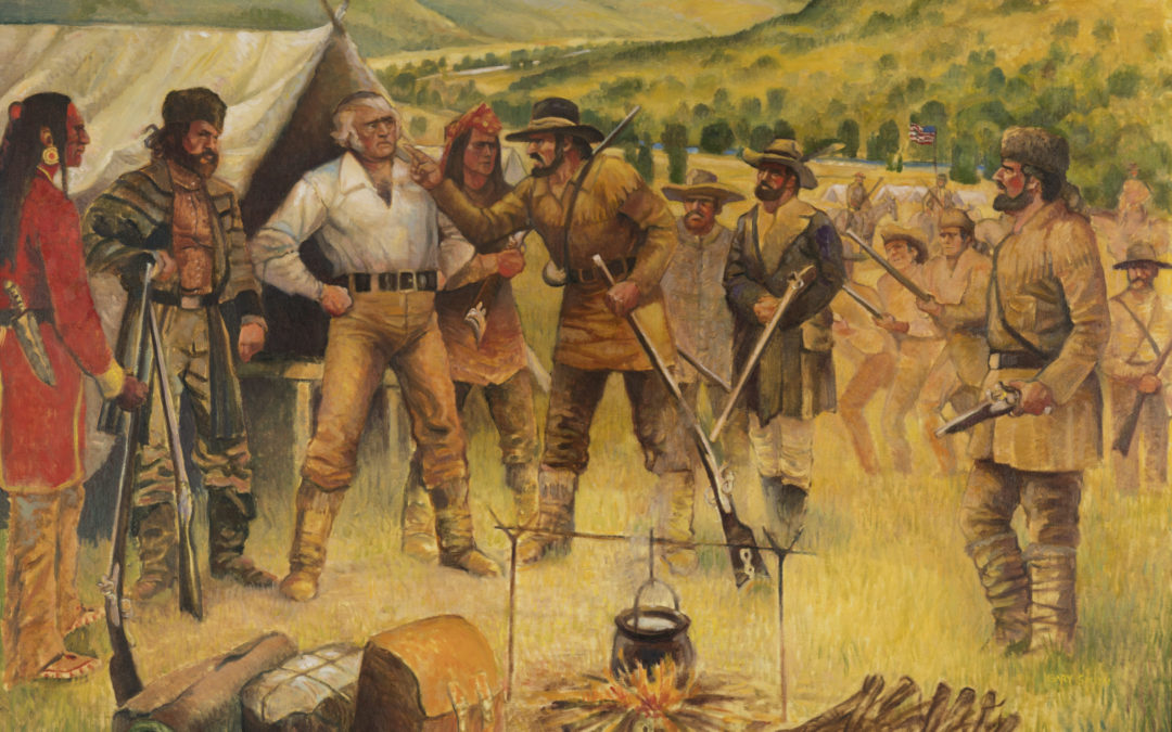
Encounter At Mountain Green HISTORIC MARKER 251 S. Mountain Rd, Fruit Heights, Utah – (Rock Loft)41° 01′ 54.5″ N • 111° 54′ 07.2″ W Atense confrontation between members of the British Hudson’s Bay Company and the Rocky Mountain Fur...
by JRobins | Mar 1, 2025 | Historic Marker
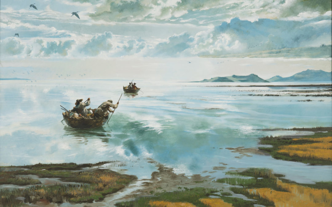
Circumnavigating The Great Salt Lake HISTORIC MARKER 1625 E. 650 N., Kaysville, Utah – (Wilderness Park)41° 02′ 48.9″ N • 111° 54′ 17.1″ W In 1826, a bull-boat was used by four men attempting to navigate the circumference of the Great...
by JRobins | Mar 1, 2025 | Historic Marker
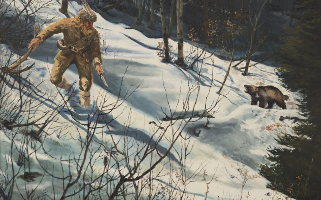
Osborne Russell Confronts Wolverine HISTORIC MARKER 1625 E. 650 N., Kaysville, Utah – (Wilderness Park)41° 02′ 48.9″ N • 111° 54′ 17.1″ W During the winter of 1840-41, trapper Osborne Russell wintered with a group of mountaineers,...
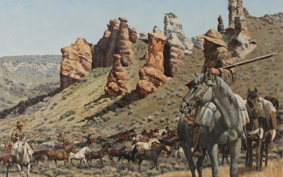
by JRobins | Mar 1, 2025 | Historic Marker
Miles Goodyear Horse Drive HISTORIC MARKER 1285 S. Angel St. Kaysville, Utah – (Pioneer Park)41° 00′ 50.7″ N • 111° 57′ 29.6″ W Miles Goodyear obtained a herd of horses with the intent to trade with emigrants along the Overland Trail....